After Dominica and Marie-Galante, Columbus’s fleet anchored for a week (November 4–10, 1493) at the twin islands close to Marie-Galante that the Kalinago or Caribe inhabitants called Caloucaera and Couchoalaoua. Columbus named them as one—Santa María de Guadalupe (Guadeloupe in French)—fulfilling a promise he’d made to friars in Spain earlier that year to name an island for their Monastery of Santa María de Guadalupe. The twin islands retain the Guadeloupe name today, and together with Marie-Galante and an archipelago of neighboring islets, constitute an overseas department and region of France.
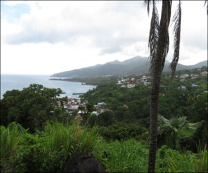
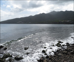
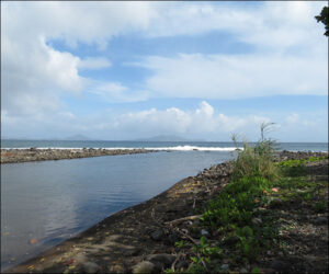
The fleet’s main anchorage was at the coves south of Trois-Rivières on Guadeloupe’s western island, Basse-Terre, principally off the black sand beach at Grande Anse shown in the first two photos below. The third photo is looking southeast from Basse-Terre to other islands of the archipelago.
As recounted in Encounters Unforeseen, the Caribe peoples (who then lived largely in the Lesser Antilles) were the historic enemy of the Taíno peoples (who lived largely to the west in Cuba, Haiti, the Dominican Republic, Jamaica, and the Bahamas). Caribes raided Taíno islands to capture women to use as brides, concubines, or slaves.
As depicted in Columbus and Caonabó, during his stopover at Guadeloupe, Columbus captured some Caribes to haul to Spain to demonstrate to Queen Isabella and King Ferdinand that Caribes profitably could be enslaved. Some Taínos captured by Caribes also sought asylum with Columbus to escape the Caribes, unaware that Columbus would treat them just as his Caribe captives and haul them to Spain, too.
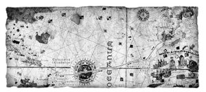
The following map (included in Columbus and Caonabó) is a portion of Juan de la Cosa’s famous world map of 1500 marked for the fleet’s voyage from Cádiz to the Canary Islands and then across the ocean to Dominica and north to the anchorage on Guadeloupe.